Thursday, November 30

November 26-28: Mission accomplished
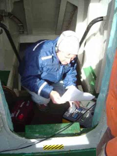
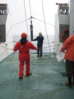
acoustic signalBob Dziak sends signal to release hydrophone


November 26-28, 2006
On board the RV Yuzhmorgeologiya
Off of Livingston Island in the Bransfield Strait

During the last three days the team has accomplished its primary mission of recovering the six hydrophones that were deployed in the Bransfield Strait in 2005. Including the hydrophone from the Drake Passage recovered last week, all of these underwater listening devices have successfully captured the acoustic information for which they were designed.
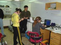
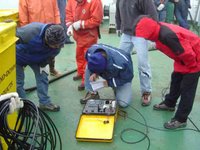
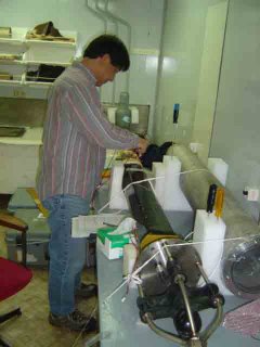
processing float dataHaru and Kate process data from recovered hydrophone


Preliminary examination of the data has shown calls from blue and fin whales, sounds of ice movement (created by cracking, free ice collisions and scraping on the sea floor) and seismic events such as underwater earthquakes.

In addition, five hydrophones have been re-deployed in the Bransfield Strait for another year of acoustic data collection. Being in limited supply, the two surplus hydrophones will be shipped back to HMSC to be deployed in other locations around the globe. It was decided that the remaining five, in slightly rearranged positions, would cover our area of interest in Antarctica.
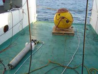
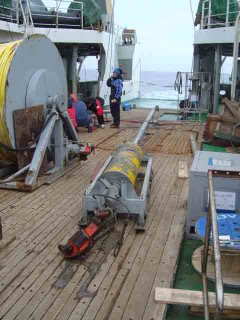
hydrophone and floatHydrophone and float await deployment


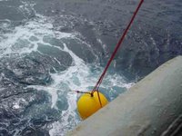
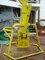
The hydrophone is an autonomous instrument, and needs to be recovered in order to retrieve its data. Its mooring equipment begins with a 500-pound, 37-inch diameter syntactic foam float, bright yellow in color for day recoveries, with an attached flashing light for the occasional night-time retrieval. Below the float is the hydrophone, suspended in the water at 400 meters below the surface. Attached to the hydrophone is a 5/16-inch thick mooring line, whose length depends on the depth of the ocean bottom at that location. This in turn is shackled to an acoustic release mechanism, which can communicate with scientists aboard the ship. The acoustic release frees the hydrophone from the anchor when the recovery vessel broadcasts a coded frequency of sound underwater. The anchor consists of eight large chain links weighing approximately 550 pounds.
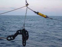
Mooring anchor and acoustic release ready to deploy


An acoustic survey to locate level seafloor must be conducted before the hydrophone is deployed. This helps to assure that the hydrophone’s heavy anchor will stay in place. After stopping to lower the syntactic foam float, the Yuzhmorgeologiya steams forward at 2 knots to play out a 50 meter leader of braided nylon, the hydrophone and approximately 1500 meters of high-test nylon rope (or more, dependent on the depth of the seafloor), before pausing again to attach the acoustic release and anchor. We then return to our original location to drop the acoustic release and anchor. The anchor requires over 10 minutes to reach bottom and lands within 100 meters of the projected location. After verifying its position with GPS, the captain turns the ship and heads for our next deployment location. Multiple locations are necessary in order to triangulate the location of any detectable sound source.

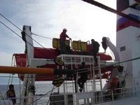
To recover a hydrophone, the Yuzhmorgeologiya uses her GPS equipment to arrive at the exact location where the hydrophone was deployed. A transponder is lowered over the side, and a coded acoustic signal is sent. If the hydrophone is nearby, it responds with its own acoustic signal. The deck box calculates the angle and direction of the signal, and the ship moves closer, if necessary. Another coded acoustic signal is sent, causing the release to open, separating the hydrophone from its anchor. The yellow syntactic foam float with a flashing light rises to the surface and the captain maneuvers the Yuzhmorgeologiya into position for recovery. Using a grappling hook thrown from the bow, the mooring is captured and attached to a line on deck. This line is run through the “A” frame crane as the Yuzhmorgeologiya moves slowly forward, positioning the float dead astern. The “A” frame crane hoists the float to the deck, where it is disengaged from the mooring line. The hydrophone is recovered next, rinsed with fresh water and carried below decks for the processing of its valuable information. The long nylon line is spooled up, ultimately revealing the acoustic release. The release is dismantled and its depleted batteries are replaced to prepare it for redeployment.

At over 3500 meters, the Drake Passage hydrophone was our deepest recovery of this cruise.

Wednesday, November 29

Nov. 28: Sea-floor view


First underwater image captured by ROV of the sea floor at Marion Bay, King George Island, Antarctica (See November 25 entry for details)

Tuesday, November 28

Did you know ...

... that you can click on these photos to see them in a larger size?

... that you can use the "Comments" link on any entry to ask questions about this research expedition? Answers will appear here; it may take a few days because the team has limited Internet access in Antarctica.

(Posted by Pat Kight, Oregon Sea Grant Communications)

Seabirds of the Southern Ocean

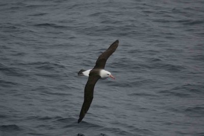
black-browed albatross
Black-brow (or black-browed) albatross. Read more about this bird.


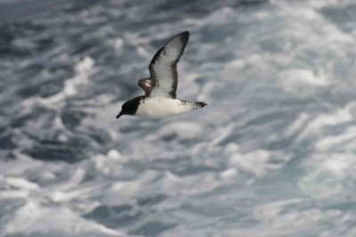
Pintado petrel
A Pintado (Spanish for "painted") petrel. Read more about this bird.


Chinstrap penguins. Read more about this bird.

November 25: Rough weather, icebergs, deploying the ROV

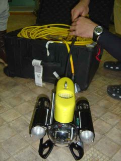
ROVThe ROV


November 25, 2006
On board the RV Yuzhmorgeologiya
Steaming through the Bransfield Strait

It has been an extremely busy day! The weather has begun to deteriorate, but in this case that means returning to its norm. Fortunately the seas are still calm enough to permit transport by Zodiac, so Andrew, Del and I returned to the Korean base for another visit to the penguin colony and to use their Internet connection. The rest of the team was involved testing the newly acquired Remotely Operated Vehicle (ROV). Dr. Dziak has generously offered to relate today’s experiences with you.

Bob Dziak writes: The ship has been anchored near the Korean Antarctic Base in Marion Cove for the past two days, but we plan to continue our hydrophone mooring recovery this afternoon. With the morning free, we decided to do a test deployment of our Remotely Operated Vehicle (ROV) in the iceberg-laden bay. The Koreans sent one of their Zodiacs to the ship, and we loaded our equipment and scrambled down the 20 ft high rope ladder into the inflatable. The seas were choppy because of a sustained 20-knot wind, but we zoomed off to the nearest iceberg some 10 minutes from the ship. Onboard the Zodiac from the Sounds of the Southern Ocean Expedition were Haru Matsumoto, Joe Haxel, and myself to handle the ROV work. Kate Stafford also came along to deploy our portable hydrophone to record the sounds of ice noise and marine mammal calls in the cove. The Zodiac was expertly driven by Mr. Yu from the Korean polar base who saw to it our work was safely accomplished.

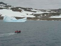
icebergsGrounded iceberg in Marion Bay; Zodiac in the foreground

The sky was grey and the Zodiac bounced in the choppy seas occasionally spraying our goggles and mustang suits with the frigid Antarctic water. It was exhilarating; I loved it! I was happy and excited that we were finally on our way to do the camera work after the many months of preparation. And the stunning scenery of Marion Cove with the enormous glaciers calving into the bay just added to the thrill of the moment. We first stopped the Zodiac in the center (and deepest) part of the cove to test the ROV’s maneuverability in open water away from any troublesome ice.

The ROV is essentially a video camera housed in a pressure-protected case that can be submerged up to 1000 feet of water. The unit has three thrusters mounted to it to allow the operator to control the vehicle’s vertical ascent/descent as well as provide left-right horizontal control. We set up the ROV equipment which includes a LCD monitor so we can see what the camera is recording at all times, a DVD writer, and 450 feet of cable to keep the ROV attached to the Zodiac. One of our main concerns was how the extreme cold would affect the ROV operations (as well as the recording and viewing capability), and so far everything worked like clockwork.

We placed the ROV in the water, did a few brief maneuverability tests, then hit the down thrust and sent it to the bottom. After all this time, I was dieing to see the seafloor! The camera quickly sank to 50 feet and settled on the bottom. The seafloor here was surprisingly full of life. Krill and amphipods darted in and out of the field of view. There were many types of algae and kelp in a variety of colors. Since the camera was only 50 feet deep, the bright lights of the ROV made the water a pale aqua color, making it look as though we were working in the tropics! There was also a surprisingly large amount of light colored particles (either sediment or organic material) being whisked through the field of view the cove currents. The good news was the ROV operations were unaffected by the currents here, and we anticipate the currents in Deception Island will be even milder. We kept the ROV in this location for several minutes while we tested each thruster and practiced zooming and focusing the camera. I was very pleased to see the camera produced exceptionally clear, crisp images. If everything goes smoothly at Deception, we should get some fantastic footage.

After this initial stop, we pulled up the ROV and motored the Zodiac over to a collection of small icebergs tucked into a little embayment at the west side of Marion Cove. This spot provided protection from the wind and waves, making the ROV work much more manageable. The icebergs here were stunning. Although only a few tens of feet high, they were the deep, deep blue that one only sees when the ice is truly ancient. It is as though we are looking back into the history of Antarctica itself.

We were rapidly running out of time allotted to perform our test before we needed to get back to the ship. We quickly put the ROV into the water and drove it down to the base of the iceberg where it was resting on the seafloor. The water was shallow at our first stop, only 15 feet, so the background light was very bright. We had the ROV circle the small bergs, zooming up and down along the ice face from the base to the water surface. The ice images, interestingly, kept coming in and out of focus on the LCD monitor. I think this is because the ice and water are nearly the same color and also because the ice surface undulates, causing the ice surface to continually fall in and out of the field of view. But the video itself did not have this affect.

After we had satisfied ourselves that we had put the ROV through its paces, we brought the ROV back onboard the Zodiac and roared off to the ship. I must say that during the ROV my excitement must have kept me warm, but on the open water trip back to the ship the numbing of the cold had set in. Thankfully it was a short trip, and soon enough we were on the ship, just in time for a filling lunch of hot chicken soup. While getting our gear off the Zodiac, I looked around at each person and saw that each of us was smiling ear-to-ear thinking of what an amazing experience we just had. What an incredible way to spend a Saturday morning, and this is just the beginning!! Thus with success declared, we set off to recover our next hydrophone in the Bransfield Strait – saying a short-live good bye to King Sejong Station.

Back to the penguin colonyDr. Del Bohnenstiehl returning to penguin colony

November 24: Revisiting the penguins

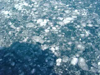
surface iceSurface ice on Marion Bay


November 24, 2006
On board the RV Yuzhmorgeologiya
Marion Bay, King George Island, Antarctica

It was difficult to believe we are actually in Antarctica. We are anchored in Marion Bay directly off shore from the Korean base. If it wasn’t for the thin layer of surface ice, the calm blue seas could have been found in the tropics. The wind conditions were calm and skies clear for the entire day.

The first order of business was to offload the supplies and personnel from the RV Yuzhmorgeologiya for the King Sejong Station, Korean’s base on King George Island. After donning Mustang suits for protection against the elements, our entire team climbed down the rope ladder into a Zodiac for the short journey to the Station.

Haru, Bob and I were here last year, but this was a new experience for the rest of the team. After checking in with the base commander, we hurried up the shore to the penguin rookery. We encountered a Weddell seal on the way. She was stretched out, utterly relaxed, and only opened her eyes as we approached. Since seals have no terrestrial predators in the Antarctic, she simply went back to sleep as we moved on.

Nesting Gentoo penguins

As we drew nearer to the rookery, its telltale odor greeted us. Moving up a snowy slope, small groups of Gentoo penguins alternately waddled and rested as they made their way. The wind was much stronger last year, masking the Gentoos’ soft calls. Their cooing and crackling were easily distinguished as we approached. The rookery is extensive; their stony nests are clustered is several areas. Most of the penguins were lying prone on their nests, keeping the eggs warm. Scattered individuals were moving about the colony. Most were either returning to sea to feed, or back to their nest to relieve their mate. However, I watched one penguin roaming about the colony, selecting individual stones and returning each to his/her nest where its mate was incubating their egg.

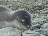
Leopard sealLeopard seal

The penguin rookery was fascinating, but more surprises waited for us down the shoreline. I was exploring the tide pools, finding limpets and algae, but little else, when I glanced up to see a motionless shape on the beach. At first I thought it might be a dead Weddell seal, but upon closer examination I saw its chest slowly rising and falling. Even more exciting, its elongated neck and head revealed it to be a young leopard seal. As I called out to the others, it awoke but didn’t stir. With every breath, milky-white mucus drained out its nostrils. As the others approached, the leopard seal warily raised its head. I was careful not to get between the seal and the water, fearful that it might charge if it felt threatened. I shouldn’t have worried though. As we passed, the leopard seal began to move across the stony beach with a labored, undulating gait. Moving so slowly, I think the penguins could out run it on land.

Elephant seal

A final surprise waited. The distinctive exhalation of a marine mammal caused me to scan the horizon for a whale. But I was looking in the wrong direction. I spun around after the next exhalation and was surprised to see an elephant seal on the beach no more than twenty feet away. With its large eyes, it was following my every move. It was time for us to return to the ship, but these memories will follow me forever.

The research team en route to the penguin colony near near King Sejong Station

November 23: Gravity, analysis

Gravity corerGravity core sampler


November 23, 2006
On board the RV Yuzhmorgeologiya
In transit of the Drake Passage towards Antarctica

The Korean researchers were up early today, using a gravity core to capture a deep-sea sediment sample. At this location, the sea floor is over 3500 meters (>11,000 feet) beneath the ocean surface. But the heavy weight of the gravity core drove a section of pipe more than 8 meters (25 feet) into the soft sediment. Korean scientists will be examining this core for evidence of past climatic change.

Drs. Stafford and Matsumoto have been busy extracting and interpreting the data gathered by the Drake Passage hydrophone. Kate was pleased to see the sound signature of a blue whale that must have been in this area shortly before we recovered the hydrophone. The Antarctic blue whale population was hunted to depletion by the 1930’s and only protected internationally in the 1960’s.
This hydrophone records sound between .1 and 110 Hertz at 250 samples/second, a sampling range ideal for recording the low frequency sounds generated by the great whales, as well as underwater seismic events and ice movement.

The cuisine on our Russian vessel is always superb. Tonight’s meal was roast duck, but it wasn’t until much later that I remembered that today was Thanksgiving. Perhaps the cook hadn’t realized the significance, but I appreciated the culinary coincidence.

The Yuzhmorgeologiya is steaming at 10 knots for King George Island, just off the coast of the Antarctic Peninsula. We expect to arrive during the early morning hours, anchor, and to begin off-loading materials and personnel after breakfast.

Tomorrow: A return visit to the Gentoo penguin colony!

November 22: Hydrophone recovery

Hydro recoveryRecovering the hydrophones


November 22, 2006
On board the RV Yuzhmorgeologiya
Drake Passage off of Antarctica

We awoke early this morning in anticipation of recovering the first of seven hydrophones deployed last year. The RV Yuzhmorgeologiya had already arrived to its station at 60 degrees, 30.00 minutes South, 61 degrees, 00.00 degrees West. The seas were smooth with long swells. Unfortunately, fog settled in and visibility was severely limited. Using the GPS we knew we were in the right area, but because of ship noise, the hydrophone couldn’t be immediately located.

Haru listens for the chirpHaru listens for the tell-tale chirp

With a portable deck box and transducer, Haru tried different locations until the sonic chirp of the hydrophone was detected. But because of the fog, the acoustical release wasn’t immediately signaled. Once released from the weight of the railroad wheel, the hydrophone would rise to the surface pulled by the buoyancy of its yellow, syntactic foam float. Even with a flashing strobe light, the float would be difficult to locate in heavy fog. The decision was made to wait until fog dissipated to signal the acoustic release.

Recovering a floatRecovering a float


The fog eventually lifted shortly before noon. Most of the crew gathered on the foredeck, scanning the horizon for the telltale float. The yellow float broke the surface less than 50 meters from the Yuzhmorgeologiya. With a grappling hook, a member of the crew secured a line to the float and moved it to the stern of the ship. Using the “A” frame there, the float assembly was raised to the deck, securing its important cargo. The hydrophone was quickly transported below decks where Haru determined that last year’s acoustic data was secure.

Inspecting the recovered hydrophone

Nov. 21, 2006: Traversing the Drake Passage

November 21, 2006
On board the RV Yuzhmorgeologiya
Drake Passage steaming towards Antarctica

Tierra del FuegoTierra del Fuego


The intense rolling motion in our stateroom awoke me near midnight. The Yuzhmorgeologiya had altered course to a more southern point early in our traverse of the Drake Passage. The ship had become a calliope of sounds: the clinking of glass striking glass, the metal squeals of doors swinging open and then slamming shut, and various thuds of unidentifiable objects hitting the deck. Though I had secured most of my gear before retiring, nagging uncertainty required that I rise to check on its status.

By morning the ship had settled into a constant rolling motion. Fortunately, no one on our team became seasick, but everyone had acquired a drunken-like stagger to successfully negotiate the corridors below decks.

Lifeboat drill
Yesterday we took advantage of the calmer sea conditions to practice “Abandon Ship” procedures. The Yuzhmorgeologiya is equipped with both life rafts and two lifeboats. The covered decks of the lifeboats are reminiscent of a submarine, ensuring that high seas would not overwhelm the hull. Even the life rafts are covered, but they don’t possess engines like the lifeboats.

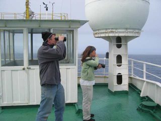
Kate and AndrewWe expect the crossing of Drake Passage to require cruising at 10 knots for at least two days. Calmer seas and clear skies have afforded Kate Stafford, our marine mammal specialist, and Andrew Young, teacher and artist-in-residence, excellent opportunities to spot cetaceans, pinnipeds, and abundant sea birds. Using a Global Positioning System, the two of them keep watch and record important sightings of Fin and Minke whales, and the occasional pod of acrobatic, bow-surfing dolphins. Because of the variable, often high-velocity winds in the Drake Passage, birds that venture the long distances are expert gliders. Some of the popular species include prions, Giant Petrels, Antarctic Fulmars, and the ever-elegant Black-browed and Wandering Albatrosses with wingspans pushing 10 feet. They are curious about the ship, perhaps looking for food or an opportunity to congregate. Twice when we have slowed to conduct experiments, we were fortunate to have the company of clownish Chinstrap penguins. As the expedition nears Antarctica, we expect to see a shift in the populations of birds and mammals frequenting the vessel, climaxing with a visit to a Gentoo penguin colony on King George Island.

Box grabWe stopped for three hours near the middle of the Drake Passage for a Korean experiment. Using Yuzhmorgeologiya’s yellow “A” frame they deployed a large instrument called a “box grab” off the stern. The box grab collects bottom sediment for analysis. We held stationary about three hours since the bottom was 3500 meters (>11,000 feet) below. Unfortunately, they couldn’t retrieve a significant sample, since the sea floor bottom in this area was too compacted.

Tonight, we will continue to steam to the south through Drake Passage. We hope to recover the single hydrophone that was deployed here last year.

Thursday, November 23

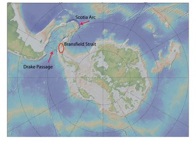
Where are we headed?

Drake Passage and Bransfield Strait


Antarctica, the Drake Passage and the Bransfield Strait, site of the expedition's hydrophone project. The team is attempting to recover and re-deploy hydrophones it deployed last year in the Bransfield Strait and Drake Passage. Using data recorded by the hydrophones, scientists hope to detect otherwise unobserved seafloor volcanic activity, monitor/track the sounds of ice break-up and the tremor produced by the movement of large icebergs, and monitor the distribution of large baleen whales in the area.

Deception Island

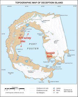
Deception Island: During last year's voyage, bad weather kept the team from approaching the island. This year, they will once again attempt to perform the first-ever ROV survey (submersible camera with propellers) of the underwater hydrothermal systems in the island's submerged caldera, in hopes of learning more about the ecology of its hydrothermal vents.

(Maps courtesy of Robert Dziak)

Wednesday, November 22

More photos from Nov. 19-20, 2006


Joe Haxel and Del Bohnenstiehl prepare equipment for sampling the water column.


Sample tube mount.

November 20, 2006

Haru assembling hydrophones
On board the RV Yuzhmorgeologiya:

The day dawned brightly without a cloud in the sky. The seas are calmer than expected. The Magellen Passage is treating us kindly. We are taking advantage of the fair weather to prepare the research equipment for deployment.

Haru Matsumoto spent the day assembling and testing the hydrophones on board. Seven hydrophones were deployed last year: one in Drake’s Passage and six in the in the Bransfield Strait between the South Shetland Islands and the Antarctic Peninsula. We hope to recover the hydrophone in Drake’s passage on our way to the Korean base on King George Island. The plan is to eventually recover all seven and re-deploy five hydrophones in the Bransfield Strait. This will require replacing their hard drives and batteries. The hard drives contain all of the acoustic data since last year, but the sounds signals can’t be analyzed until our return to the States.

Batteries power both the hydrophone and acoustic release. In fact, there are 150 “D” cells (flashlight batteries) in each hydrophone. These provide power both to the sound amplifier and hard drive. The batteries in the acoustic release are necessary to open the coupling between the hydrophone and the railroad wheel. The railroad wheel acts as an anchor, maintaining the hydrophone at a specific depth. When the acoustic release is activated, a previously attached float brings the hydrophone to the surface for recovery.

Joe Haxel and Del Bohnenstiehl were preparing equipment for another type of essential research: sampling the water column. The chemistry of the seawater changes as it circulates in an active vent system. Vent systems can be detected by the presence of different types (isotopes) of helium.

A CTD array (Conductivity/Temperature/Density) will be lowered from the ship. CDT arrays consist of 12 or more bottles that can be selectively closed at different depths to capture and isolate different seawater samples. Joe and Del constructed special copper sample tubes that will be used to transport the seawater samples back to the laboratory for analysis. The plan is for six casts of the CDT to obtain 40 samples.

I’m retiring to our cabin tonight under high clouds and relatively calm seas.

(Photo: Haru Matsumoto assembles hydrophones)

Nov. 20: Posted for Bob Dziak


November 20, 2006:

Hello this is Bob Dziak and I am the U.S. chief scientist of the Antarctic Hydrophone experiment. I am checking in as we steam our way southwest from Chile Patagonia around the east side of Tierra del Fuego toward the Drake Passage. It is a gloriously clear, sunny day and I must say it is an awesome feeling to be crossing waters where some of the most important events in human history have occurred and some of the greatest figures of civilization have traversed. For example, the protected passage way west out of Punta Arenas harbor to the Pacific Ocean is named the Beagle Straits in honor of Charles Darwin’s ship. The passage way east to the Atlantic Ocean is called the straits of Magellen for the legendary Portuguese discoverer, and of course the open water between South America and Antarctica is named after the Sir Frances Drake who first blazed his way through these rough seas in the 1500s. The snow-capped peaks of Tierra del Fuego are visible off our starboard side as we steam south. The “land of fire” was so called by Magellen because of the large amounts of smoke on the island they attributed to the warning fires of hostile natives telling them to stay away, although the fires were more likely caused from lightening strikes or even the smoke my have just been dense fog.

Excitement is very high as the expedition begins. The weather is stunningly beautiful and everyone is in a correspondingly good mood. All hands are diligently preparing their equipment and themselves for the cold adventure ahead. We expect to arrive at the first hydrophone site in the Drake Passage in two and a half days. The forecast is for 20-25 knot winds and 6-9 foot seas – downright tropical by southern ocean standards! But as the Russian Captain Igor keeps reminding us, “of course this is the weather now, but in 15 minutes, who knows?” There have been many discussions about the hydrophone instrument recoveries, but also a lot of focus (and excitement) has been on the work to be done once we are inside the steaming volcanic harbor of Deception Island. We are also eagerly awaiting our first at sea encounter with an iceberg (meaning only that we see it from a safe distance) to confirm we are nearing our frozen destination.

-- Bob Dziak

(Photo: The science team aboard the Yuzhmorgeologiya)

November 19, 2006

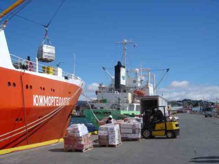
Loading the Yuzhmorgeologiya


(Note: Internet access aboard the RV Yuzhmorgeologiya is limited; Bill is sending his log entries back to Oregon Sea Grant in batches for posting here)


Sunday dawned with bright skies and a brisk breeze. As much as we enjoyed the ambiance of Punta Arenas, I was eager to be back on board of the RV Yuzhmorgeologiya. By 10:00 we had transferred personal belongings to our cabins and I set about re-acquainting myself with the ship. She has acquired a fresh coat of paint and the name on the bow was now scribed with Russian lettering. Surprisingly, navigating the maze of corridors and stairs below decks was quickly relearned.

We left the ship as loading of equipment and supplies from the quay continued. RV Yuzhmorgeologiya is re-supplying the Korean base in Antarctica. In preparation of crossing the usually treacherous Drake’s Passage, large tanks of propane and other compressed gasses were secured to the deck. Many other stores and supplies were lowered by crane into the Yuzhmorgeologiya’s hold. We took this opportunity for one last meal ashore to enjoy fresh Chilean cuisine. As Internet connections are unreliable from the Southern Sea, this was also my last prospect for posting logs and images until we reach the Korean base in Antarctica.

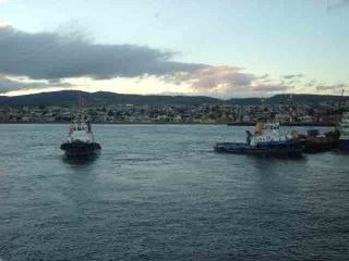
Moving a 300-foot vessel from the dock required two tugboats and the coordination of many men on deck. Light lines were tossed up from the tugboats to the Yuzhmorgeologiya. These were tied to heavy hawsers, which were brought onboard and secured to large cleats on our port side. As the Yuzhmorgeologiya employed her bow thruster full abeam, the tugs churned astern, slowly overcoming the inertia of our large vessel. With creaking hawsers, we were pulled safely away from the quay, and then gently pushed in the direction of the open ocean.


We are steaming tonight through relatively protected waters to the Straits of Magellen, and anticipate reaching the passage separating South America and Antarctica sometime in the early morning. Tidal currents in the region where we are currently traveling can reach up to 18 knots. A low-pressure system to the west is moving towards us with winds projected between 20 and 30 knots. We have secured all of our research equipment and personal belongings. Though I don’t usually suffer the effects of motion sickness, wearing a seasickness patch seems prudent in this situation.

(Photos: Loading the Yuzhmorgeologiya; Steaming out of Punta Arenas)

Monday, November 20

more images


Snow-capped peaks of the Andes as seen during the flight from Santiago, Chile to Puerto Mont.


The RV Yuzhmorgeologiya, the 300 foot Russian icebreaker which will be the research team's base of operations while in Antarctica.

Santiago airport

November 17/18

Aerial view of the Andes
November 17, 2006

Promptly at noon four of us (Drs. Bob Dziak and Haru Matsumoto, Joe Haxel and myself) left PDX to begin our Antarctic adventure. Last year we shipped the hydrophones and much of our equipment three months prior to our departure date. This time, however, we are traveling with most of our equipment, including the small ROV (Remotely Operated Vehicle) that we hope to deploy in Deception Island.

Our flight first took us to Dallas where we rendezvoused with Dr. Kate Stafford, a specialist in the study of marine mammals from the University of Washington. Mark and Stacy Schatzman, former colleagues from Oregon, whisked us away for a taste of authentic Texas cuisine. When we returned to the airport, Andrew Young, an artist and educator from Chicago, joined us. Andrew, an Illinois Arts Council Grantee, will lend his educational and creative leanings to record new and changing events in the harsh environment that is Antarctica.

More than nine hours of flight, and three additional time zones, separates Dallas, Texas from Santiago, Chile.

November 18
In Santiago the final member of the U.S. team joined us: Dr. DelWayne Bohnenstiehl from North Carolina State University. Del is the co-principal investigator of this NOAA research project and has worked with Bob in the past. His current research efforts include monitoring earthquakes and undersea eruptions around the world. Del also uses hydrophones to monitor the Comprehensive Nuclear Test Ban Treaty and has detected sounds of ice movement thousand of kilometers distant. Del is anticipating being able to locate and understand what is generating these sound signals.

The flight from Santiago to Puerto Montt was heralded by clear skies and broad vistas. Magnificent scenes of the Andes’ snow-capped mountains, slopes etched by streams and blue tinged lakes, continually swept the view from our aircraft. As last year’s flight was marked with cloud cover, this perspective was both welcomed and unexpected. We can only hope for similar weather conditions during the research cruise.

Though the weather remained mild throughout the day, high clouds blanketed the sky between Puerto Montt and Punta Arenas. The temperature dropped from above 15 C (60 F) to 10 degrees (50 F). But if you have the opportunity to travel by air through Chile, I can highly recommend LAN Airlines. Both the comfort and service exceed those provided by any of today’s U.S. airlines.

As we approached Punta Arenas, I eagerly scanned the coastline, looking for the Russian vessel RV Yuzhmorgeologiya. This 300 foot Russian icebreaker will be our base of operations while in Antarctica. After landing we joined her at the dock, dropping off the ROV and other equipment. We spent Saturday night ashore before boarding the RV Yuzhmorgeologiya on Sunday morning.

Tuesday, November 14

Project Summary

Map of Bransfield Strait research area
SOUNDS FROM THE SOUTHERN OCEAN – 2006

Research Objectives
1) First deep-water hydrophone deployment in Drake Passage and Bransfield Strait, Antarctica
2) First deep-water (greater than scuba depth) ROV survey of hydrothermal vents and ecosystems at Deception Island, Antarctica
3) First long-term, microseismic survey of seafloor tectonic and volcanic activity in Antarctica
4) First study of possible link between ice movement and seafloor tectonic/volcanic activity in the Antarctic
5) First acoustic survey of the presence and distribution of large baleen whales (blues and fins) in the Bransfield Strait
6) First test of active subduction processes at South Shetland Islands (King George Island), Bransfield Strait.

We are attempting two main projects this year:
1) Recover and re-deploy our hydrophones in the Bransfield Strait and Drake Passage that were deployed last year. The goals of the work are to detect otherwise unobserved seafloor volcanic activity, monitor/track the sounds of ice break-up and the tremor produced by the movement large icebergs, and monitor the distribution of large baleen whales in the area that are globally endangered. The poles are the "canaries in the coal mine" when it comes to global climate change, meaning they are the most sensitive and will be first to show the effects. Glaciers in Antarctica are known to be receding, likely due to an increase in ocean temperatures. Speculating a bit, we are also looking to see what contribution to large ice breakup might be from natural (i.e. volcanic) phenomena. A common misconception of Antarctica is that it is an ice-covered, lifeless rock. Instead, it is a tectonically and volcanically dynamic region, filled with surprising and numerous heat sources.

2) Perform the first ROV survey (submersible camera with propellers) of the underwater hydrothermal systems in the submerged caldera of Deception Island. There is the possibility that both photo- and chemosynthetic ecosystems exist in hydrothermal vents found in the caldera. All previous studies of these vent communities were conducted in deep water, below the reach of sunlight. This observational study will attempt to identify interactions between light-dependent (photosynthetic) organisms and the chemical-dependent microbes (Archea), which form the base of the hydrothermal community.

I will be filing log reports and pictures this year at: http://hmscblog.blogspot.com. These will be collected and posted at both the Sea Grant and OceanExplorer web sites.
The daily logs and pictures from our 2005 research voyage to Antarctica can be found at two different sites:
http://seagrant.oregonstate.edu/extension/hanshumaker.html
http://oceanexplorer.noaa.gov/explorations/explorations.html

Look for "Sounds from the Southern Ocean".
- BILL