November 29-30: Water sampling, ice bergs and ocean pressure
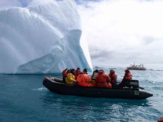
 Loaded into the Zodiac, the team transports the ROV past an iceberg in Marion Cove for its final test.
November 29-30, 2006
On board the RV Yuzhmorgeologiya
Marion Cove, King George Island, Antarctica
We have been extremely busy during these last two days. After recovering and deploying the final hydrophone, we steamed to Hook Ridge at the eastern end of the Bransfield Strait. There we conducted deepwater sampling until 3:am on the 29th. This consisted of four casts of a reconstructed CTD at different locations, the deepest down to 1300 meters. A plume signature was detected here in 1999, and we are trying to resolve its exact location.
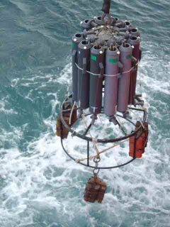
 Casting a rosette of Niskin bottles off the stern of the Yuzhmorgeologiya
This CTD rosette consists of eleven Niskin bottles that are closed to capture water at different depths. Each cast required 2-3 hours. Once on deck, two water samples are carefully removed from each bottle. The first set of samples will be analyzed back at HMSC for dissolved helium gas. Helium gas is the most reliable indicator of an active hydrothermal system. The second sample will be analyzed for total dissolved metals often found in a hydrothermal plume.
After just a few hours of sleep, we roused briefly to experience our closest approach to the mainland of Antarctica. Dozens of icebergs were obscured by low-lying clouds, but were revealed by the Yuzhmorgeologiy’s radar. From the deck the occasional ‘berg would make a brief appearance, only to be masked by flurries of falling snow. Before the ship turned back towards King George Island, our team met on the afterdeck for a ritual offering to Pele.
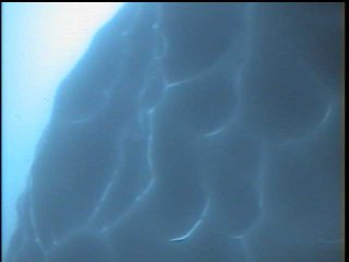
 Bottom view of an ice berg captured by ROV video camera
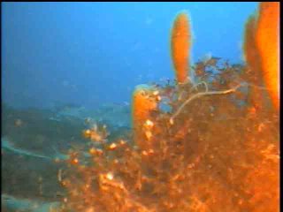
The next day dawned brightly, and we were at anchor in Marion Bay, in front of the Korean base, King Sejong Station. Along with Del and Andrew, I returned to the base to take advantage of their Internet connection. The rest of the team loaded the ROV into a Zodiac and conducted final tests of our equipment. They were successful at launching and navigating the ROV down to the bottom of Marion Cove, to a depth of ~130 feet. The remainder of the day was spent processing research data, some of which I can share with you here. They obtained stunning underwater videos as well. These will be posted on web sites, upon our return.
 Invertebrate fauna in Marion Cove at 130-foot depth, viewed via ROV
 Tonight we are steaming towards an active volcano, Deception Island. I am excited to see what awaits us in its sunken caldera.


0 Comments:
Post a Comment
<< Home